Summit elevation: 5,689 feet
Holy Jim Trail: 17 miles with 4,400 feet of climbing
Harding Truck Trail to Four Corners: 18 miles with 3,500 feet of climbing
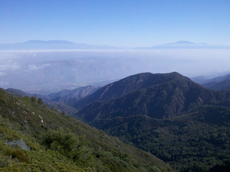
At 5,689 feet, Santiago Peak is the highest point in Orange County. Santiago Peak and Modjeska Peak are also known as Saddleback Mountain. Santiago Peak offers great views of Mount San Gorgonio, Mount San Jacinto, and Mount Baldy, as well as of Orange County and the Pacific Ocean.
Holy Jim Trail

Route Profile • Holy Jim Trail
Holy Jim Trail is named after James Smith, a beekeeper in the late 19th century.
The hike starts in Trabuco Canyon (dirt road). Half of a mile to the trailhead is paved. Holy Jim Trail crosses Holy Jim Creek several times, then it forks. The right trail leads to Holy Jim Falls for a quarter of a mile, the left trail leads up to Main Divide Road for three miles.
Turning left, Main Divide Road leads up to the summit. Turning right for less than half of a mile, Upper Holy Jim Trail serves as shortcut and offers views of Mount San Gorgonio and Mount San Jacinto. It rejoins Main Divide Road after less than a mile, which leads up to the summit for two miles.
Harding Truck Trail
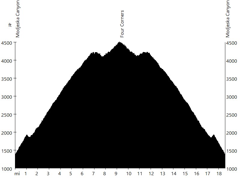
Route Profile • Harding Truck Trail
Harding Truck Trail starts in Modjeska Canyon and leads up to Four Corners for nine miles. The fire road offers views of Orange County.
Santiago Peak • Interactive Map
Santiago Peak • Pictures

Holy Jim Trailhead

Lower Holy Jim Trail

Main Divide Road
View of Mount San Gorgonio and Mount San Jacinto

Upper Holy Jim Trail

Main Divide Road

Santiago Peak
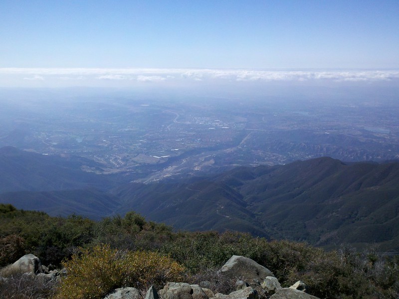
View of Orange County

View of Mount Baldy
By: B. Straehle
See Also: Hiking & Backpacking